Finished! Looks like this project is out of data at the moment!
FISHstory Volunteers – You’re Rock Stars! Thanks to your incredible efforts, every photo in our current FISHstory archive has now been classified. Our team is diving into data analysis, and we’ll be updating the results section in the coming months.
We’ve also scanned a new batch of historic photos, and we’re excited to begin processing them for addition to the project this summer. Stay tuned — there’s more FISHstory on the way!
Research
Stepping Back In Time
Travel back to the docks of the South Atlantic U.S. from the 1940s through 80s through the South Atlantic Fishery Management Council's (SAFMC) project, FISHstory. This project trains citizen science volunteers to identify and count fish and people in historic fishing photos. Data collected with your help will provide a novel picture of the fishery prior to dedicated monitoring programs and help improve our understanding of the fishery for several iconic species.
Much of the finfish harvest in the South Atlantic U.S. is dominated by recreational fisheries where data are limited, especially during historic time periods. Historic fishing photos document the beginnings of the South Atlantic U.S. for-hire fisheries and are an untapped source of data that can help recreate information on catch and length composition prior to when dedicated catch monitoring programs began. Species and length composition data can be critical to accurately estimate stock productivity. Unlocking the data in these photos not only helps us better understand these historic fisheries, it also helps to evaluate assumptions about stock productivity which can inform stock assessments.
Analyzing the photos will help provide better information of what people were catching during this time period, seasonality of their catches, and possibly estimate a rough catch per angler which can provide insights on the health of fish populations.
How FISHstory Got Started
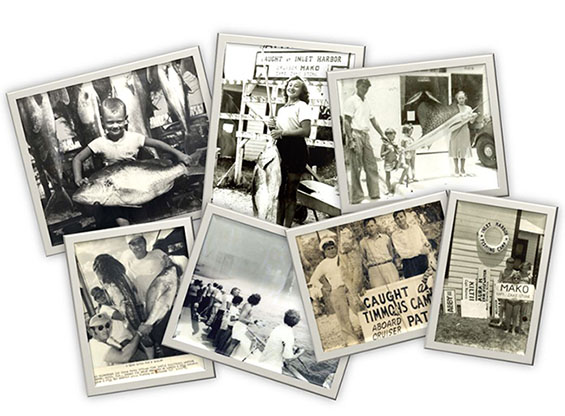
Rusty Hudson, a fisherman out of Daytona Beach, Florida has been involved in South Atlantic U.S. fisheries for many years. He approached fisheries scientists in the region about the large photo archive he had from his family’s fishing fleet in the 1940s-1970s. Rusty saw the value in what these photos could provide - helping document historic catches before dedicated catch monitoring programs began. Working collaboratively with Rusty and scientists in the region, Council staff hatched the idea for the FISHstory project.
So what are you looking at?
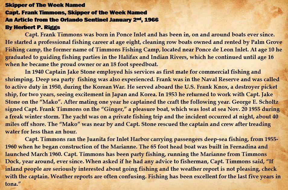
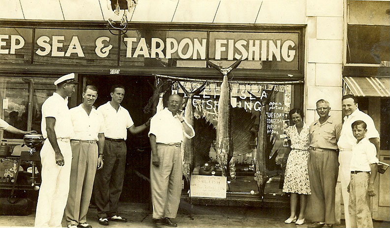
Each photo represents a single fishing trip. Groups of passengers would pay to be taken out on one of the vessels within the fleet. These vessels were designed to provide passengers with a comfortable space to fish while the captain and crew made sure they enjoyed their time on the water. The captain and crew would select different fishing locations depending on the weather, time of year, and other factors. When the vessel returned to the dock they would unload the day's catch. These photos were taken to commemorate the customer's day on the water. The photos were often retained at the docks for promotional use and the customers could buy a copy for their photo albums.
Validation Process
Because fish identification can be challenging, we have a team of fish ID experts, comprised of both scientists and fishermen, who will help review photos when there isn't agreement of the types of fish found in a photo. To learn more about this process or to request to be part of the Validation Team, drop us a line in the "Talk" section.
About The South Atlantic Fishery Management Council
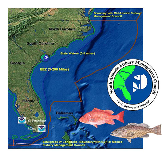
The South Atlantic Fishery Management Council (SAFMC) is headquartered in Charleston, South Carolina and is responsible for managing fisheries in federal waters from the North Carolina/Virginia border to the Florida Keys. Federal waters refers to waters 3 to 200 miles offshore. The council is made up of 13 voting members including representatives from the commercial and recreational fishing sectors along with representatives from each state in the region. We manage 70 different species and have 7 different fisheries management plans. To learn more about SAFMC or to get involved, please visit our website: safmc.net
SAFMC Citizen Science Program
Having adequate and timely data to support effective fisheries management is an on-going challenge. Current data collection programs face limited resources which can often lead to data gaps. Fishermen in the South Atlantic U.S. have consistently expressed a desire to become more involved in collecting the data used to manage their fisheries. As a result, the SAFMC developed its Citizen Science Program. The program was built under the guidance of a wide array of stakeholders and partners and aims to develop and support projects based on the SAFMC’s research needs. To learn more about SAFMC's citizen science program visit our website: SAFMC Citizen Science
FISHstory Project Locations
Pilot Project
The FISHstory pilot project included photos of fishing trips departing from Inlet Harbor and Timmons Fish Camp in Daytona Beach, Florida. These locations were family run operations with multiple vessels. Today fishing charter trips still leave out of Inlet Harbor, while Timmons Fish Camp has since become a seafood restaurant.
Fishing locations varied depending on the vessel, season, weather, or even day. Because of this the depth of water fished and, subsequently, the species caught vary. The maps below show some of the typical fishing locations.
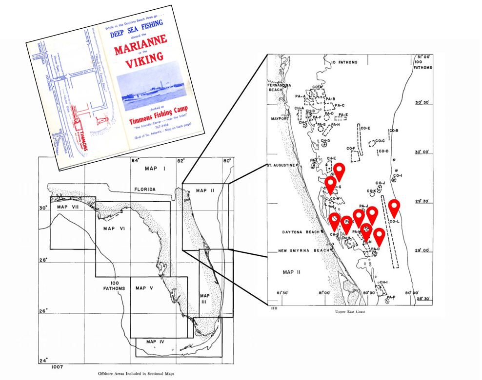
Map provided by: Moe, M. A. (1963). A Survey of Offshore Fishing in Florida (Rep. No. Four). Retrieved August, 2019, from http://sedarweb.org/docs/wsupp/SEDAR24-RD08_Moe1963.pdf
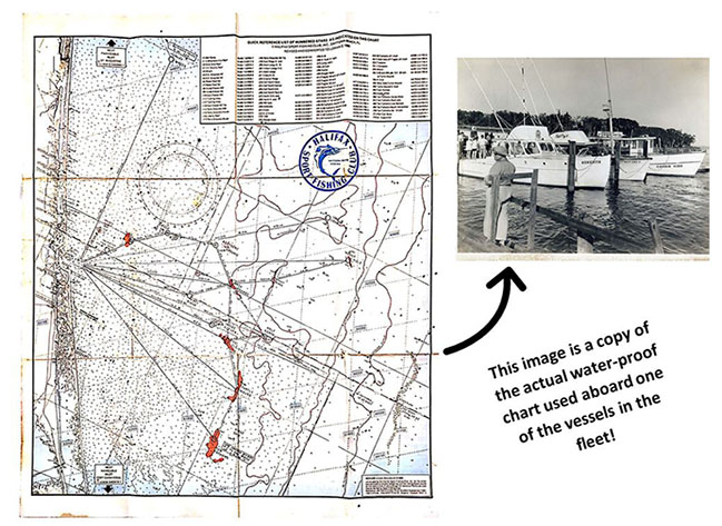
Halifax Fishing Chart provided by Rusty Hudson
FISHstory locations are expanding!
Once the FISHstory pilot project wrapped up, we’ve been busy gathering photos from fisherman across the South Atlantic U.S. to help the project grow. Thanks to generosity of fishermen, organizations, libraries, and restaurants in our region - we’re proud to share that the FISHstory photo archive now includes photos from the Outer Banks of North Carolina down to Key West, Florida.
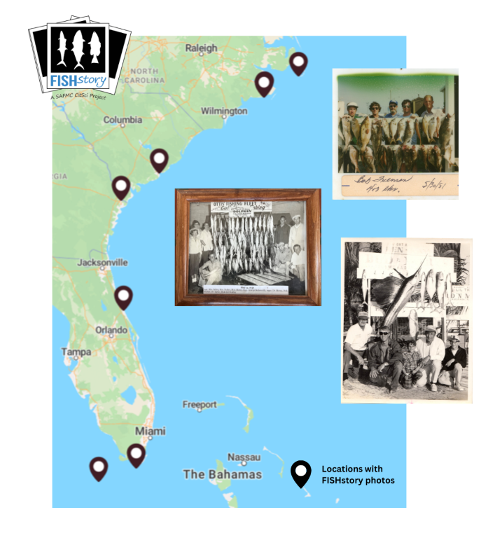
Map of locations with FISHstory photos. Photos in figure were provided (from top to bottom) by Captain Robert Freeman, Sanitary Fish Market & Restaurant and Jeff Garner, and Captain Skip Neilsen.
Meet The Captains and Vessels
FISHstory involves not just fish, but people as well! Our photos show fishing and family history. The men and women shown in the FISHstory photos were born and raised on the water and their passion for fishing shows. The captains and vessels highlighted below were captured in many of the photos archived and classified during the FISHstory pilot project. As the project continues to grow, we’ll be updating this section to introduce you to more of the people and boats behind FISHstory.
Rusty Hudson
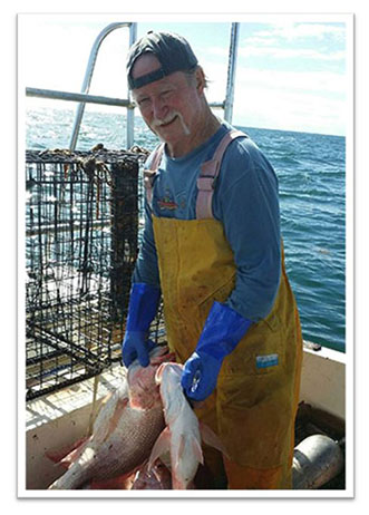
Russell Howard Hudson, aka Rusty, was born in 1955 in Greenville, SC. His fishing career started at an early age. By age 4, Rusty was fishing with his family at Timmons Fish Camp in Ponce Park, FL. Because he was a child in a US Air Force family, he spent over three years in Japan.
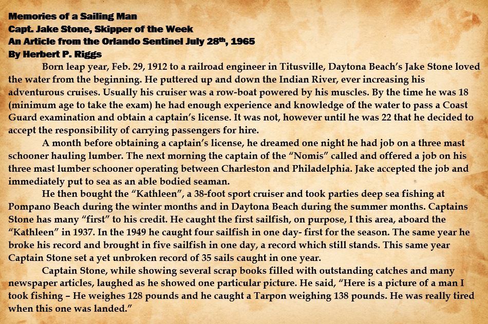
By 1964 Rusty had returned to FL and was working aboard both the Mako and the Broadbill with Captain Jake Stone, his grandfather, and Captain Bob Stone, his uncle. Rusty also worked aboard The Flamingo, another one of Jake Stone’s vessels, and worked within the commercial fishing and shrimping sector with other captains in the Inlet Harbor fleet.
Rusty has provided FISHstory with not only the historic photos documenting his family’s trips on the water, but a wealth of knowledge on identifying fish, information on the state of fisheries at the time, regional fish names, and FISHstory design input. Without him FISHstory would not be possible.
Thank you!
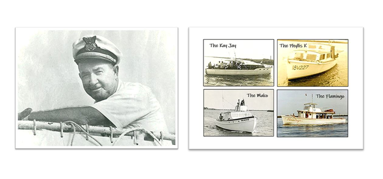
Jake Stone
The Kay Jay, The Phyllis K, The Mako, and The Flamingo
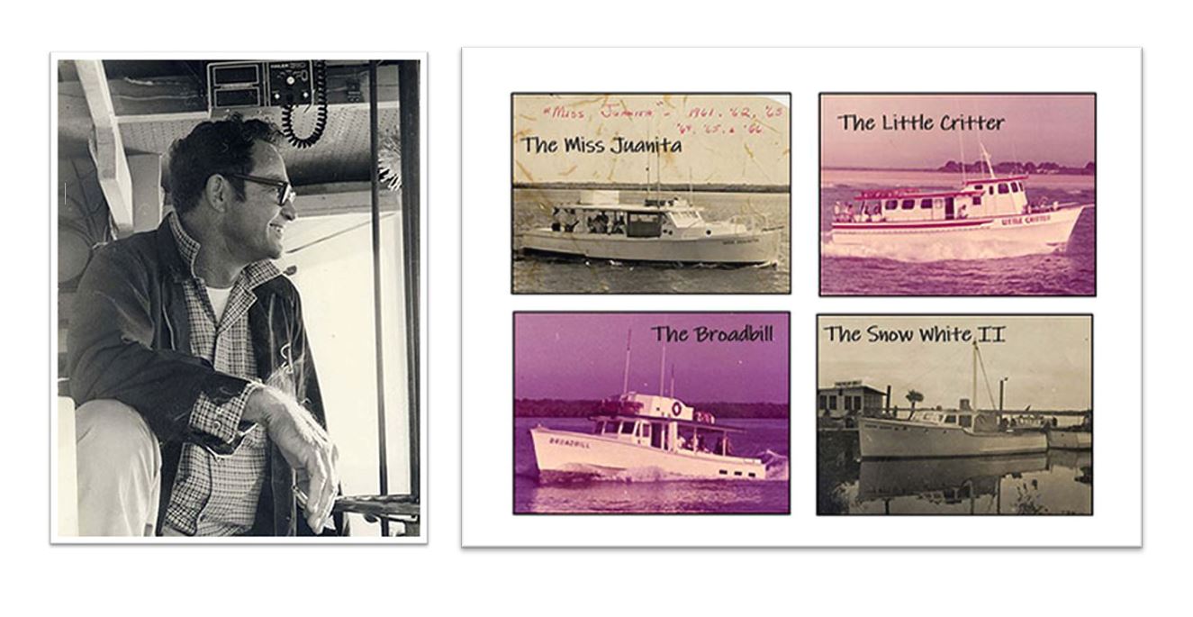
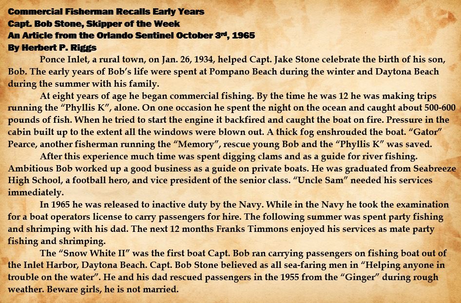
Bob Stone
The Miss Juanita, The Little Critter, The Broadbill, and The Snow White II
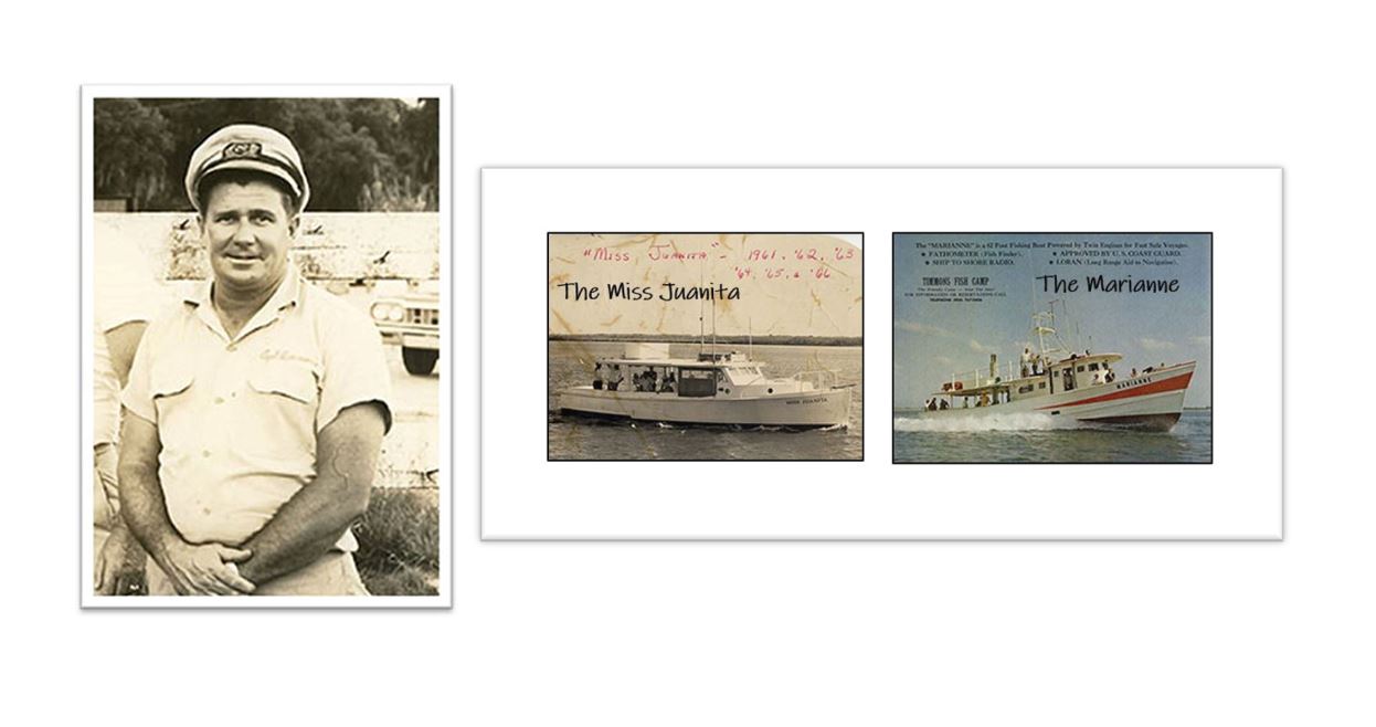
Frank Timmons
The Miss Juanita and The Marianne
